
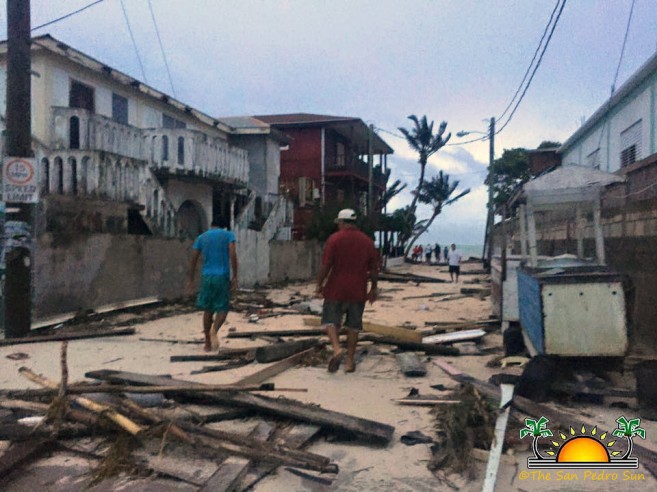
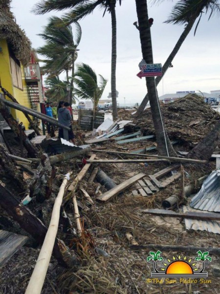
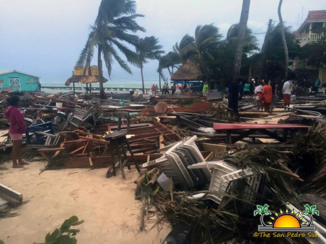 Hurricane Earl has come and gone, and it has left a path of destruction along its path. In San Pedro Town on Ambergris Caye, several homes were severely damaged, while along the beach many businesses and docks were partially or completely destroyed.

The tropical cyclone formed late Sunday, July 31st on the Caribbean Sea and by Tuesday, August 2nd had become a tropical storm. The storm quickly strengthened and by the time it made landfall near Belize City in the early hours of Thursday, August 4th, it had become a hurricane category 1. Earl had maximum sustained winds of 80 miles per hour and was moving at 14 miles per hour.
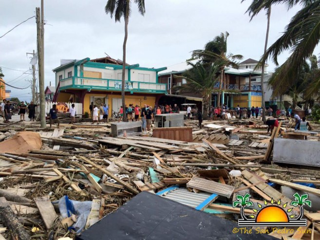
According to local authorities on Ambergris Caye, the preliminary damaged assessment shows significant structural damage and beach erosion. In the meantime, the National Emergency Management Organization (NEMO) remains active as they complete their assessment, while residents who passed the storm at the respective shelters await to hear when they can return home. Furthermore the San Pedro Town Council has started cleaning up the island.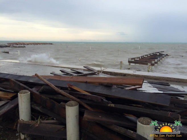
Power and water remain off. In a text message sent to customers at 8:22AM today, Belize Electricity Limited stated, “Belize Electricity Limited is assembling its team to prepare for assessments of the power system. Currently, only the Corozal and Orange Walk Districts have power supply. BEL will provide an update by 10am regarding its assessment plan.” No word has been issued by Belize Water Service Ltd as of yet.
During the hurricane two houses were reported to have collapsed by the San Mateo Area, while two fires were reported due to electrical outages/surges. No human loss or injuries have been reported.
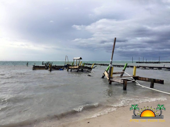
At break of dawn, island residents could be seen walking along the beach area where most of the damage took place. Massive piles of debris belonging to the many dive shops, businesses and docks that had been destroyed made the pass way almost impossible. Other parts of the island experienced minimal impact besides fallen trees, light posts and damaged power lines.
The latest advisory from NEMO states that all is clear for the country of Belize. At that the center of now Tropical Storm Earl was located near latitude 17.2 North, longitude 89.9 West or about 50 miles west of Belize City. Earl continues to weaken as it tracks westward away from Belize. Earl is expected to become a tropical depression by Thursday night or Friday morning.
This is a developing story and we will continue updating.