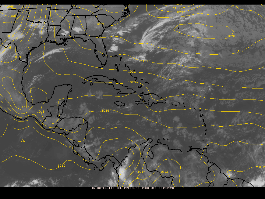
Valid Time: Monday, Feb. 27, 2012 until Monday, Mar. 5, 2012
Feature(s) of Interest:
The feature of interest this working week will be a persistent ridge of high pressure extending from the north-western Atlantic to the western Caribbean. This feature will keep a fresh and relatively unstable easterly airflow prevailing through Thursday, and will favour some showers, mostly over the sea and coast during the morning and inland during the afternoon hours.
A cold front will move SE across the Gulf of Mexico as we move into the weekend, but the models are predicting that the frontal boundary will become quasi-stationary over the SE Gulf and the Bay of Campeche by late Sunday and early Monday. The proximity of the frontal boundary to the NW Caribbean will result in a backing in the low level flow, with the winds shifting to the N and NE, and favouring some pre-frontal showers later on Sunday and Monday over Belize.
The weather will be seasonally fair with cloudy spells on Monday through Thursday. We can expect some showers mostly over the coastal zone during the morning hours and over some inland places during the afternoon and evening. Conditions will become drier and warmer on Friday through most of Sunday with little rainfall. Showers will increase once again during the afternoon and night on Sunday through Monday due to the proximity of the next frontal zone near the Yucatan peninsula.
Daily rainfall accumulations from Monday through Thursday of this week will range from 0.10-0.25 of-an-inch, decreasing later on Thursday through most of Sunday. Daily rainfall totals will increase later on Sunday through Monday, with totals ranging from 0.25-0.50 of-an-inch over central and northern coastal areas and over the sea. Elsewhere, rainfall totals on Sunday through Monday will be in the range of 0.10-0.25 of-an-inch.


Belize Five-day Outlook for Agriculture and Industry…
| Mon | Tue | Wed | Thu | Fri | Sat | Sunday |
|---|---|---|---|---|---|---|
| Feb. 27, 2012 | Feb. 28, 2012 | Feb. 29, 2012 | Mar. 1, 2012 | Mar. 2, 2012 | Mar.3, 2012 | Mar. 4, 2012 |
| Mostly sunny with isolated showers.
Rainfall: 0.01- 0.10 of-an-inch | Cloudy at times with a few showers.
Rainfall: 0.10-0.25 of-an-inch | Cloudy at times with a few showers. Rainfall: 0.10-0.25 of-an-inch | Mostly sunny with isolated showers. Rainfall: 0.01-0.10 of-an-inch | Mostly sunny and dry.
Rainfall: nil
| Mostly sunny and dry.
Rainfall: nil | Cloudy at times with a few showers. Rainfall: 0.10-0.25 of-an-inch
|
Monday,
Feb. 27, 2012
RFrutos, Agrometeorologist/Hydrologist

