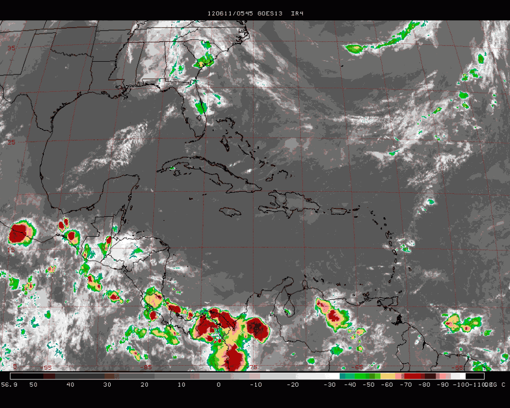
PERIOD: Sunday, June 10 until Monday, June 18, 2012
DATE ISSUED: Sunday, June 10, 2012; 3:00 pm
SYNOPSIS:

Moisture will increase over Belize and the NW Caribbean from the eastern Pacific on Sunday night and Monday, while a diffluent wind flow pattern will dominate the upper atmosphere ahead of an approaching trough from the west during the next 72 hours. A weak tropical wave will reach Yucatan and Belize by Friday morning. Coupled with this feature will be a surface low forming over or just offshore Belize by late Thursday and Friday. The Models resolved this low to deepen a bit before drifting ENE into the western Caribbean by late Saturday and early Sunday.
During this week we can expect conditions to become more favorable for outbreaks of showers and thunderstorms. The thunderstorm activity will increase later on Thursday and Friday, and the unsettled weather will continue across the country over the upcoming weekend through Monday of next week.
Daily rainfall accumulations will range from 0.10-0.25 of-an-inch on Sunday and Monday, but will increase to 0.25-0.50 of-an-inch on Tuesday and Wednesday, mostly over central and northern areas. Daily rainfall totals on Thursday, Friday and Saturday will be ranging from 0.50-1.75 inches, especially over the central and NE areas of the sea and the mainland on Friday. Rainfall will then be concentrated in the South on Sunday and Monday.
Belize Seven-day Outlook for Agriculture and Industry…
| Sun | Mon | Tue | Wed | Thu | Fri | Sat |
|---|---|---|---|---|---|---|
| June 10, 2012 | June 11, 2012 | June 12, 2012 | June 13, 2012 | June 14, 2012 | June 15, 2012 | June 16, 2012 |
| Cloudy spells with a few showers & thunderstormsmostly southern and central areas.
Rainfall: 0.10-0.25 of-an-inch |
Cloudy spells with a few showers & thunderstormsmostly southern and central areas.
Rainfall: 0.10-0.25 of-an-inch |
Cloudy spells with a few showers & thunderstorms mostly over NE coastal areas.Rainfall:
0.25 – 0.50 of-an-inch |
Cloudy with outbreaks of showers & thunderstorms increasing mostly north and central areas.Rainfall:
0.10-0.25 of-an- inch |
Cloudy with more out-breaks of showers & thunderstormsmostly over central & northern areas
Rainfall: 0.75-1.25 inches
|
Cloudy with out-breaks of showers & thunderstorms mostly NE sector of the mainland.Rainfall:
0.50-1.75 inches |
Cloudy with outbreaks of showers & thunderstormsmostly central and northern areas.
Rainfall: 0.50-0.75 of-an- inch |


OUTLOOK FOR THE MAIN DEVELOPMENT REGION (MDR) OF THE TROPICAL ATLANTIC BASIN
Tropical cyclone formation is not expected in the Tropical Atlantic Basin during the next 48 hours.
Summary of Atlantic Basin 2012 Hurricane Season Forecast:
| Tropical Cyclones |
NHC 1981-2010 Seasonal Average |
CSU (Klotzbach & Gray) |
NOAA |
INSMET (Cuba) |
|---|---|---|---|---|
| Named Storms (NS) |
12 |
10 |
9-15 |
10 |
| Hurricanes (H) |
6 |
4 |
4-8 |
5 |
| Major Hurricanes |
3 |
2 |
1-3 |
— |
| Atlantic NS |
7.1 (INSMET) |
8 |
||
| Caribbean NS |
1.5 (INSMET) |
1 |
||
| Gulf of Mexico NS |
2.0 (INSMET) |
1 |
||
| Probability of at least one moving through the Caribbean Sea from Atlantic |
50% (INSMET) |
55% |
||
| Probability of at least one forming and reaching hurricane intensity within the Caribbean Sea |
43% (INSMET) |
15% |
Expected 2012 activity in the Atlantic Basin
Climate signals and evolving oceanic and atmospheric conditions, combined with dynamical model forecasts, indicate that a near-normal 2012 Atlantic hurricane season is most likely. This outlook calls for a 50% chance of a near-normal season, a 25% chance of an above-normal season, and a 25% chance of a below normal season.
An important measure of the total overall seasonal activity is NOAA’s Accumulated Cyclone Energy (ACE) index, which accounts for the intensity and duration of named storms and hurricanes during the season. This outlook indicates a 70% chance that the 2012 seasonal ACE range will be 65%-140% of the median. According to NOAA’s hurricane season classifications, an ACE value above 111% of the 1981-2010 median reflects an above-normal season. An ACE value below 71.4% of the median reflects a below-normal season.
Consistent with the expected ACE range, the 2012 Atlantic hurricane season is predicted to produce (with 70% probability for each range) 9-15 named storms, of which 4-8 are expected to become hurricanes, and 1-3 are expected to become major hurricanes. These ranges are centered near the 1981-2010 period averages of 12 named storms, 6 hurricanes and 3 major hurricanes. (Source: NOAA, June 2012)


