PERIOD: Monday-Monday, July 30-Aug. 6, 2012
DATE ISSUED: Monday, July 30, 2012 ─ 3:00 pm
RFrutos
EcoSolutions & Services
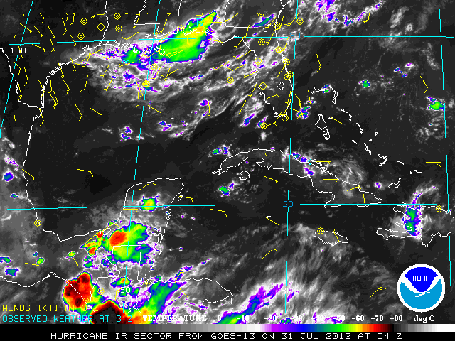
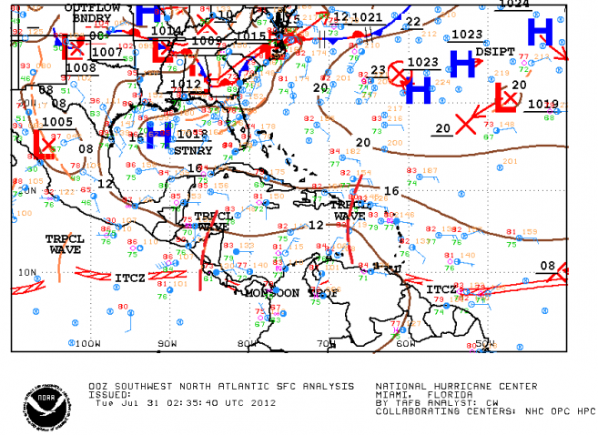
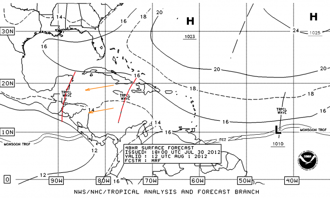
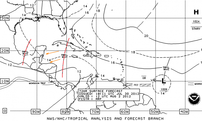
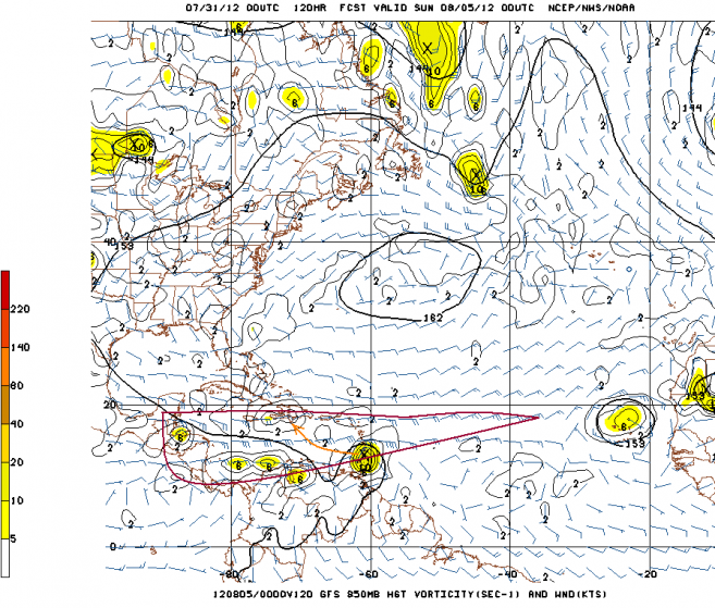
SYNOPSIS: The features that will influence weather conditions across Belize this week will be the approach and passage of a weak tropical wave on Wednesday morning (Figure 3 below), and a second tropical wave reaching Belize by Friday morning (Figure 4 below). This second tropical wave will be the remnants of the very active easterly wave or perturbation that will be traversing the eastern and central Caribbean this week. Meanwhile, an upper level low in the southern Gulf of Mexico will provide support for scattered thunderstorms over Belize on Saturday and Sunday. Another well defined tropical disturbance is forecast to move across the Lesser Antilles on Saturday evening (see Figure 6 below). This system is projected to move towards Hispaniola and weaken.
Daytime heating will add to the instability associated with the tropical waves on Tuesday and later on Friday, resulting in renewed outbreaks thunderstorms over central inland areas and the coast, especially. Otherwise, the weather during the next seven days will be a mix of sunshine and localized, brief showers.
Daily rainfall accumulations will range from 0.25-0.75 of-an-inch in the northern and central coast on Monday and Tuesday. Elsewhere, rainfall totals will be 0.10-0.25 of-an-inch. Daily rainfall accumulation will be a minimum on Wednesday and Thursday, but we can see an increase on Friday through until Monday, when daily totals will range from 0.50-1.00 inch especially in the hilly areas and some parts of the central and northern coastal zone. Other areas will be getting daily accumulations of 0.25-0.50 of-an-inch during this period.

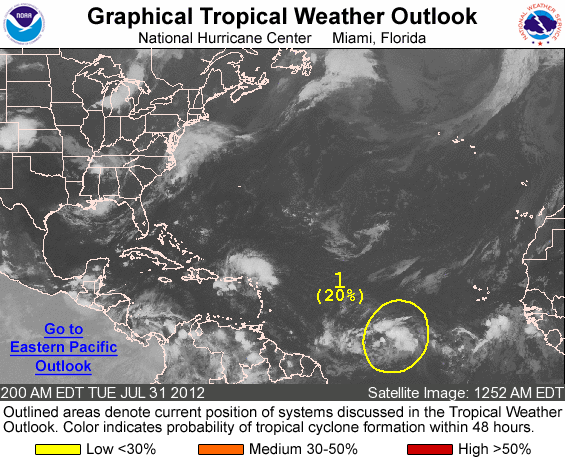
OUTLOOK FOR THE MAIN DEVELOPMENT REGION (MDR) OF THE TROPICAL ATLANTIC BASIN
ZCZC MIATWOAT ALL
TTAA00 KNHC DDHHMM
TROPICAL WEATHER OUTLOOK
NWS NATIONAL HURRICANE CENTER MIAMI FL
200 AM EDT TUE JUL 31 2012
FOR THE NORTH ATLANTIC…CARIBBEAN SEA AND THE GULF OF MEXICO…
1. A WEAK AREA OF LOW PRESSURE ASSOCIATED WITH A TROPICAL WAVE LOCATED ABOUT 1100 MILES WEST-SOUTHWEST OF THE CAPE VERDE ISLANDS CONTINUES TO PRODUCE DISORGANIZED SHOWER AND THUNDERSTORM ACTIVITY. ENVIRONMENTAL CONDITIONS APPEAR CONDUCIVE FOR SOME GRADUAL DEVELOPMENT OVER THE NEXT FEW DAYS…AND THIS SYSTEM HAS A LOW CHANCE…20 PERCENT…OF BECOMING A TROPICAL CYCLONE DURING THE NEXT 48 HOURS AS IT MOVES WESTWARD AT 10 TO 15 MPH.
ELSEWHERE…TROPICAL CYCLONE FORMATION IS NOT EXPECTED DURING THE NEXT 48 HOURS.
FORECASTER PASCH


