
Advisory No. 1 – Potential Tropical Cyclone #15 – As at 3:00 pm, Friday, 18th October 2024
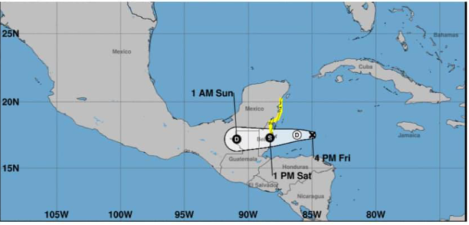
At 3 pm local time, potential tropical cyclone 15 (PTC 15) was located near latitude 17.5N, longitude 85.0W or about 210 miles east of Belize City. PTC 15 was moving to the west-northwest at 7 mph with maximum sustained winds of 35 mph. A general westward motion is expected tonight before the system reaches land tomorrow. Slight strengthening is expected an the system could become a low end tropical storm with winds of around 40-50 mph before it makes landfall over Belize tomorrow.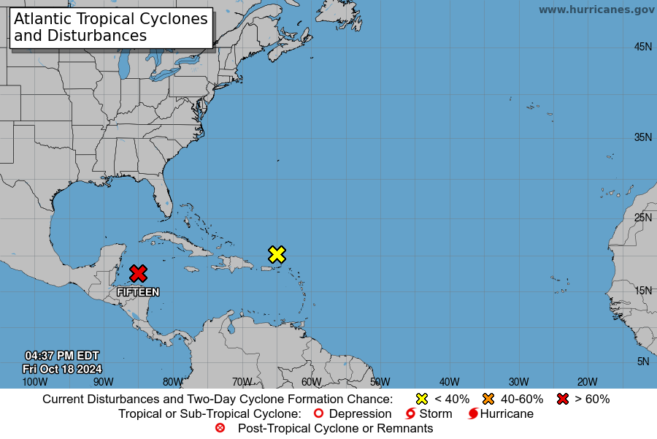
The main threat from this system will be heavy rainfall with totals of 4 to 8 inches possible especially over northern and central Belize. This could result in flooding. Strong gusty winds will result in rough sea conditions and mariners are advised to remain or seek safe harbour until the all clear is given. Some coastal flooding is expected north of the where the system makes landfall. Strong winds north of the centre may result in some minor structural damage to weak structures. Residents from Dangriga to Belize City that are currently not under a tropical storm watch are asked to keenly monitor the progress of this system as the tropical storm watch may be upgraded to warning and extend further south.
The National Emergency Management Organization (NEMO) continues to urge the public to remain vigilant as flood conditions may be possible. Residents of the Belize, Corozal and Orange Walk Districts are urged to remain vigilant, particularly all communities that in flood prone areas.
NEMO continues to advise the general public to:
• Update family and business emergency plans and be prepared to put these into action. Check your emergency food, water and medical supplies. Check on the elderly and people with disability.
• Shelters have been identified in the Corozal District, Orange Walk District, Belize District and San Pedro Town. These will open if required.
• The public are advised to clear drains to reduce flooding.
• Interests in the agriculture and fisheries sector are asked to monitor closely. Interests in the tourism sector are asked to keep visitors and guests informed of the status of AL95.
Residents are advised to continue monitoring this system very closely and to follow official information coming from NEMO and the Met Service. Countrywide, all NEMO district emergency operations centres remain on alert. NEMO’s hotline is 936.
NEMO reminds everyone that it is still hurricane season, and staying safe should remain a top priority. Ensure your emergency plans are up to date, stock up on essential supplies, and stay informed about weather updates from reliable sources. Let’s work together to keep our community safe and prepared.